


On a very chilly February morning, DiscoDeb and I went for a quick walk down to Ludschurch. It’s a great little adventure that is only an hour and is a very good fitness walk. It incorporates quite a steep incline down to Ludschurch and the same can be said for the way back too. We parked up at Roach End and started the descent.

The grassy start soon gives way to a stony path


At the bottom of the path you ascend slightly and are greeted with the following sign. We followed path to ‘Ludschurch Swythamley’

The ascent continues. The path here can be very muddy, but underfoot was frozen and gnarly.


The next sign and we followed ‘Ludschurch & Ridge’

The path is well worn, but flat with no incline. We hit another sign and continue to Ludschurch.

Wooden walkways have been laid here which help greatly.

DiscoDeb approaches the concealed entrance to the famous Ludschurch.

Entrance is gained either to the left or right of this sign.

It’s a good job this sign is here as it would be a nasty fall if you weren’t watching where you were going and were distracted.

Steep rocky path down into the ravine


Amazing how the path winds between the two cliffs

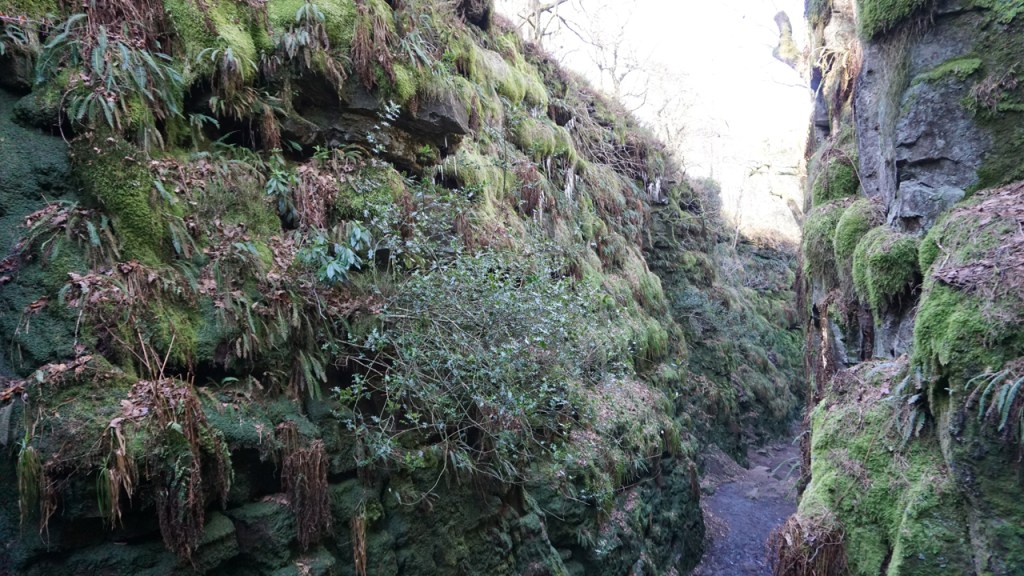

Icicles were hanging from all the rocky outcrops and were truly magnificent

We climbed back up out of the ravine on the opposite side of the sign. Hands and feet are needed 🙂

We left the way we came but upon reaching the first sign we turned right ‘Roaches’ and headed up the fairly steep hill.


Take a left here to follow the ridge back to Roach End (Roaches). The views from here are excellent and you can see ‘The Cloud’ and ‘Hanging Stone’.
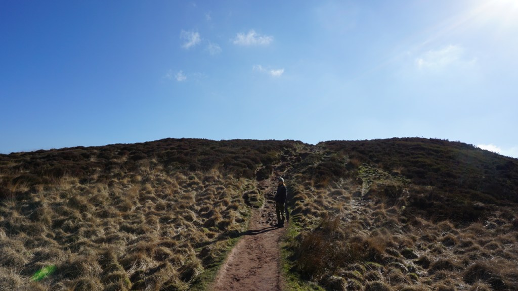


The path gently undulates up to Roach End and is an hour well spent. Great for fitness and blowing away those cobwebs.


And here are the statistics. Also, the actual length of the walk is 1.79 miles. I forgot to click stop on my garmin. The route is from the green arrow and back to the green arrow.

#sheldontours